This weekend a friend and I decided to walk the starting – or ending – point of the G2G Rail Trail in Ontario.
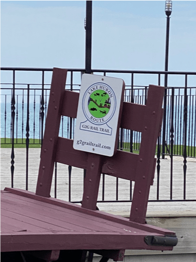
The G2G, or Guelph to Goderich trail is an ~130 km public hiking trail on what was once a railroad link between the towns of Guelph and Goderich. Now maintained by a non-profit and funded through public donations, it is a wonderful way to experience the beauty that South Western Ontario has to offer.
Given that it is on the smooth path of what were once trail tracks, it is a great starting point for an avowed couch potato such as myself.
For the last 5-6 months, we have been, in little bits and pieces, attempting to traverse the entire track. We will some days do just 1-2 kms. And on other more adventurous days, we have gone up to 9 km. This is not being done in any particular order. Our goal isn’t to do it synchronously. We just pick a random spot along the trail, and walk it.
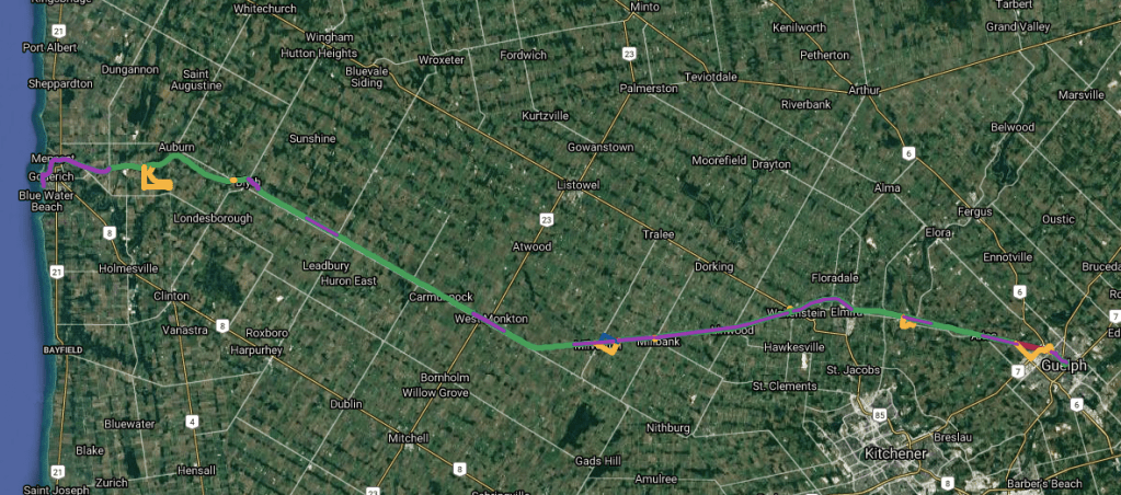
To keep track, my friend has created a map of our efforts, and it is exhilarating to see the progress we make.
A few weeks ago, we decided to do the starting point in Guelph. As it is within the city, we both thought it would be the least exciting of our adventures. We were so happy to be proven wrong. Running along the Speed River, we saw geese, ducks, rabbits and many other creatures blossoming along with the shrubs and trees as spring began to make itself known.
This May Two-Four weekend, we decided to bookend the trail, by doing the Goderich trailhead. And so it was that, at 7:45 am on a rainy Saturday morning, I found myself embarking on the 90 minute drive to Goderich.
Side note: for longer stretches of our walks, we employ the “2-car” system. We take 2 cars, park one car at the end, drive together in the other to the starting point and park. We the walk the trail back to the first car, and drive back to the car parked at the start of our trek.
Anyways, since Goderich was far and out of the way, we decided to meet at the trailhead, and decide our exact path from there.
We had checked the weather the day before. There was only a 40% chance of thunderstorms in the morning. Those are fighting odds, no?
The drive there was a mixture of grey skies and torrential downpours. The optimist in me took this as a positive: if it rained now, the clouds would be empty by the time we started our walk, no? Yes? Uh huh!
I got to our meeting point first. The number of cars surprised me. I mean – there is a lockdown, why were other people beside me outdoors? 😛
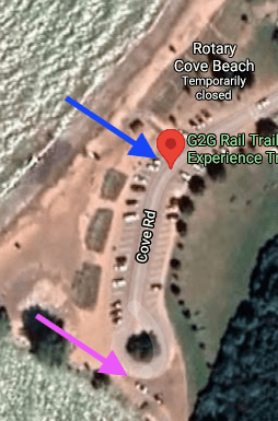
I kept driving past the blue arrow, and unknowingly became a part of a procession of slow cars lazily winding their way along the beach.
There were huge fences installed beside the road blocking access to the beach, and if that weren’t enough, the authorities had attempted to remove all ambiguity through large signs posted every 20 ft stating “NO BEACH ACCESS” and “PLEASE AVOID CONGREGATING”.
People actually seemed to be listening.
At 9:30 am, I parked my car by the pink arrow. It was an uninviting rocky edge overlooking the water. Most cars made the loop and drove away. There were only 3-4 other cars parked there, each no closer than 20 ft from the other.
With the rain pounding down, I sat in the car and waited for a few minutes. After a while, it seemed to ease off, so I stepped out, put on a jacket, grabbed my umbrella, and stepped atop some stones to take in the crashing waves of Lake Huron. After a bit, I turned to look at the other cars parked nearby.
The only way I can describe it was as a convention of Drug Dealers Inc. Socially distanced of course. (I find the need to insert this fact every paragraph or so. Yes, I was following the rules!)
The two cars on either side of me had males with over-gelled hair and loudly printed button-down shirts. And they were looking my way.
Ok, time to get back into the car J
Anyways, 15 minutes after I’d arrived, my friend parked his car beside mine. I made a dash through the rain to sit in the passenger seat so we could plot our next move.
We both agreed that, although the weather at present wasn’t conducive to walking, it surely had to clear up in a while. I mean, we had driven all that way to walk! And when we make a plan, by golly we make it happen!
So, we decided to explore Goderich while we waited for the clouds to get the rain out of their system.
We both really enjoy looking at houses – both old and new. Goderich is an old city, established in 1827, and is still an active seaport.
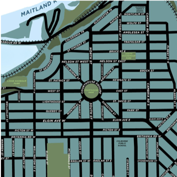
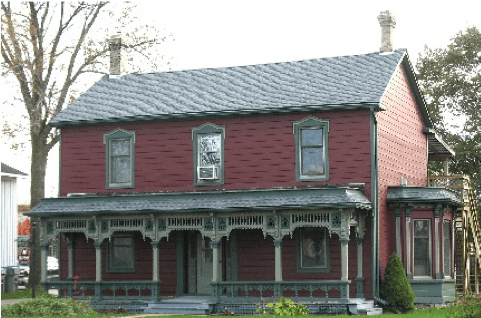
It is designed around a central park. One by one, we drove down the main thoroughfares emanating from the center. And the houses did not disappoint. After about an hour or two of driving around, the rain finally decided to somewhat abate. We set off for the starting point of our hike.
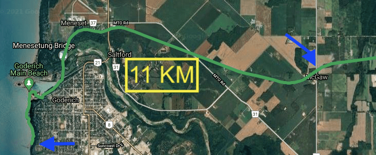
We parked the car on Lucknow Rd in McGraw – though it truly felt as though it were the middle of nowhere. We put on our jackets and hats, opened up our umbrellas and set off on our walk through the rain that was in turns spitting, pounding or gone.
Though I much prefer walking when it is NOT raining, I didn’t mind the weather. It wasn’t cold and it wasn’t windy. The rain was just there, and our umbrellas were enough to keep us from getting miserable.
The rain let off after about 3-4 kilometres into our trek, and we put our umbrellas away.
We weren’t the only ones out walking. Covid lockdown has made hiking one of the few activities that can be done safely; we passed cyclists, joggers, walkers, and many puppies and dogs.
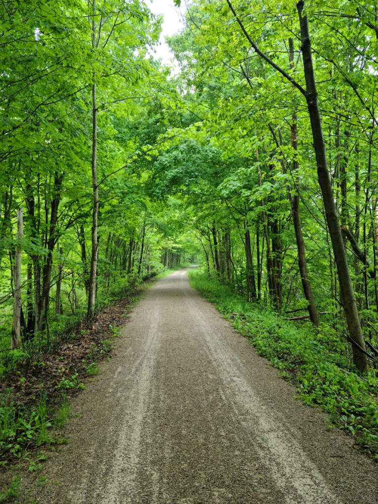
As we crossed Westmount Line however, we came across a site I did not expect to see. A group of 5 young men dressed in what appeared to be accurate military uniforms from a century ago. They carried mock(?) riffles, and one of them even sported an era appropriate (natural) red moustache! Upon asking them, we learned that they were a part of a Canadian War re-enactment troupe.
I’m still grinning now thinking about them. I think the best part was how in character they were. They were obviously having fun, and owned it!
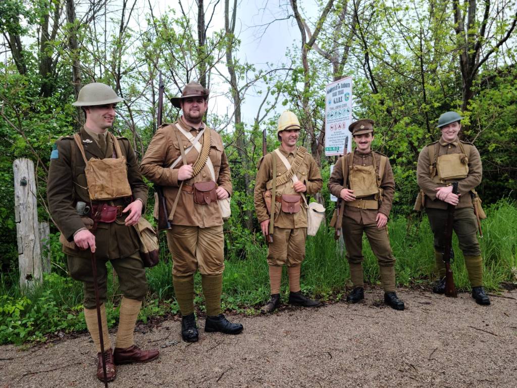
About a kilometre after that, we traversed the bridge over Bluewater Highway. Right past that we saw a sign pointing off the trail to go see the Dunlop Tomb. Of course, we had to go explore it! Turns out it was a historic site, and we learned quite a bit about the early settlers of the region.
By this point we were in a well-travelled stretch of the trail. There were many more people, a lot more of the awkward single file walking making sure we all stayed 6 ft away from each other while remaining polite and attempting to have the “great day for walking, eh?” conversations.
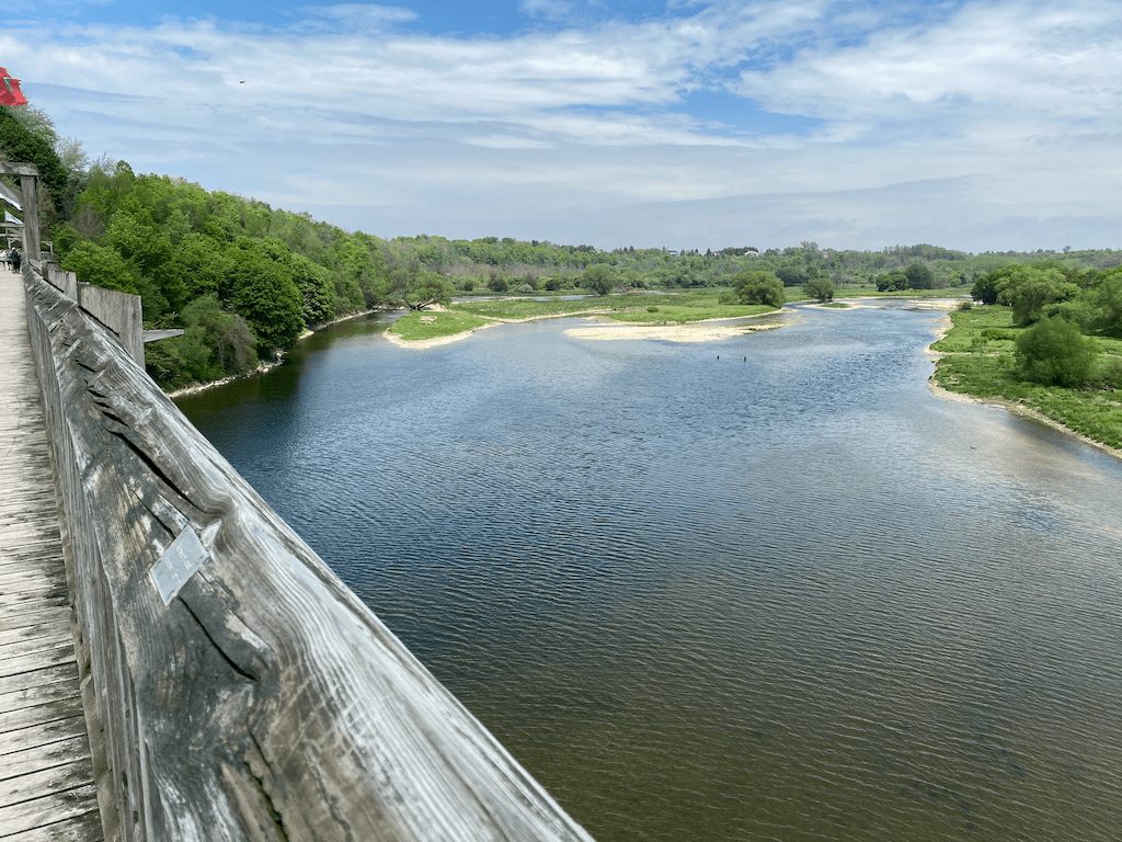
We next made our way to the wooden bridge over the Maitland River.
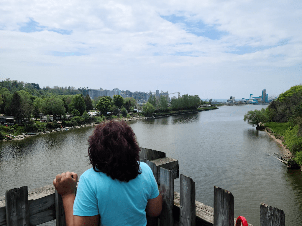
The bridge offered gorgeous views of the meandering river well below us. Even more interesting was the fact that it still had the original slabs from the railway track. The only difficult part of the bridge was staying away from all those other people!
Off the bridge, we passed by the huge grain elevator and silos of the Goderich Elevator and Transport Company.
We were comfortably tired by this point and looked forward to reaching our final destination. Hunger was also becoming a thing. Luckily for us, the end point of the trail was (obviously) a train station that had been converted into a restaurant. Right? Right?!?
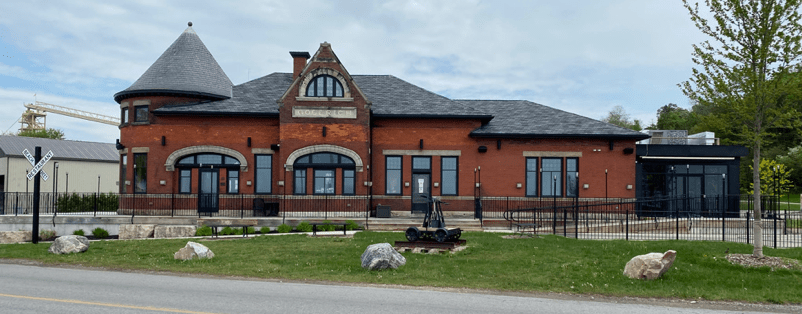
No! We had reached there at around 2pm, and the place didn’t open till 4:30. No!!!
We made very sure of this by walking around the place a few times to try to see any sign of food being sold).
But we had done it!! We had reached the end of the G2G Trail!
There was something vastly satisfying in the knowledge that we had book ended the trail. We have now completed both the ends and all that is left is to finish off are the remaining bits in between!
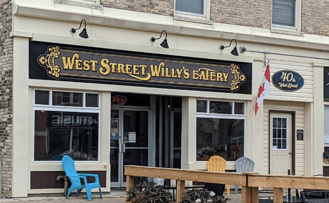
After celebrating our achievement, we made our way back to the car. The decision was made to go pick up the other car, then find some food. We drove back to Lucknow Rd, placed an order for food from West Street Willy’s Eatery, located in downtown Goderich, and drove back to town.
After picking up our food, we walked to the central park, sat on a bench and ate our food under the very welcome warmth of the sun. Nearby, a group of children played on scooters, and a young girl, perhaps 6 years old, chased after a bird that fluttered tantalizingly within reach.
When lunch was finished and the boxes had been recycled, we stayed put for a while. It had been a lovely day, from beginning to end, and neither of us wanted it to end.
All in all, we walked over 13 km that morning, and my Fitbit told me I’d hit over 21,000 steps. Not bad for an old couch potato like me!
(Oh, I’d like to give a huge shout out to John Green’s new book The Anthropocene Reviewed for giving me inspiration to write! And in his honour, I give walking the G2G trail: 5 stars!)
